Arcadia Commons
I’m on the board of Arcadia Commons, a local nonprofit formed in 2013 to protect and care for greenspaces around East Kensington. This is a large poster I created to help visualize our area of focus, and the organization’s mission.
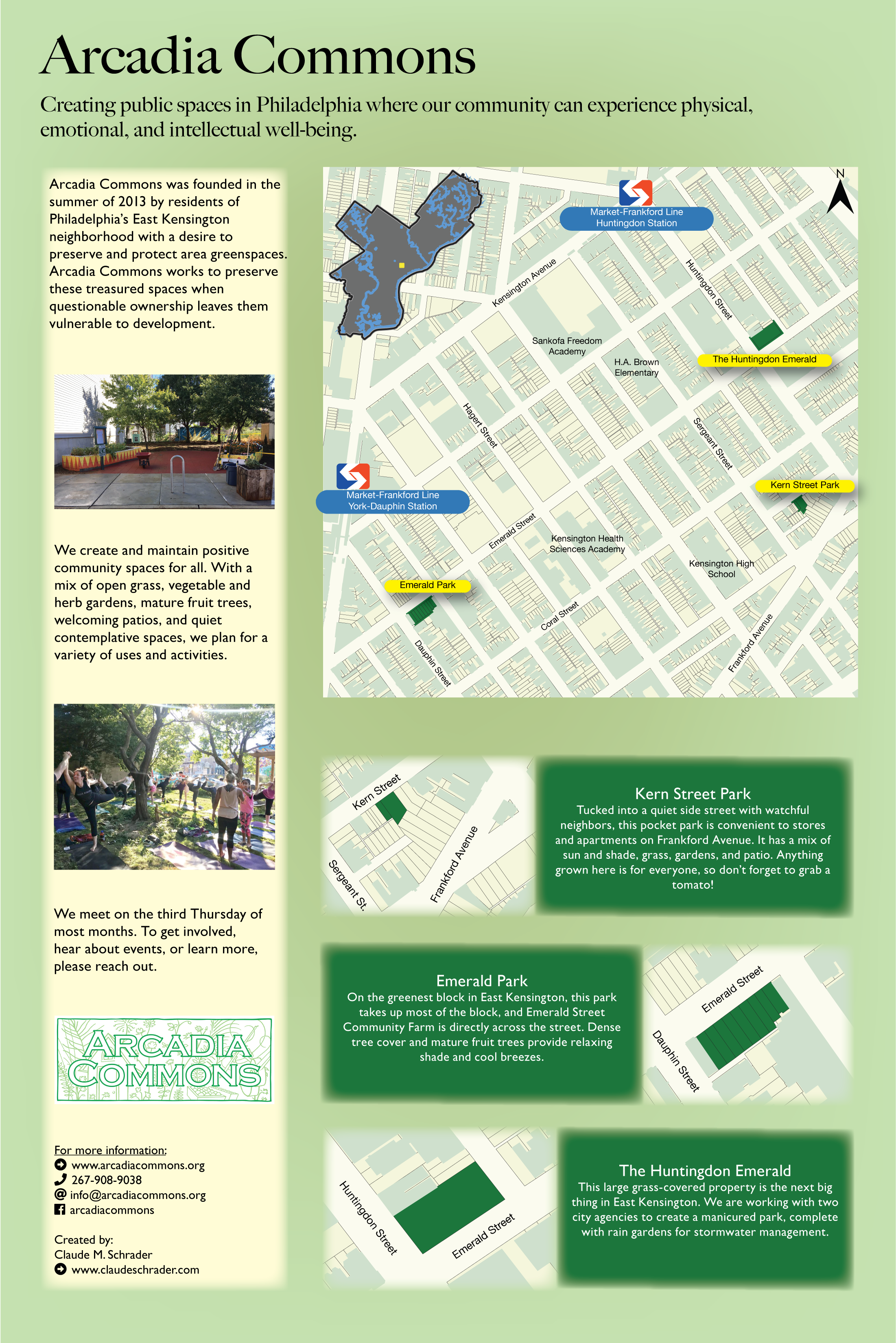
I’m on the board of Arcadia Commons, a local nonprofit formed in 2013 to protect and care for greenspaces around East Kensington. This is a large poster I created to help visualize our area of focus, and the organization’s mission.
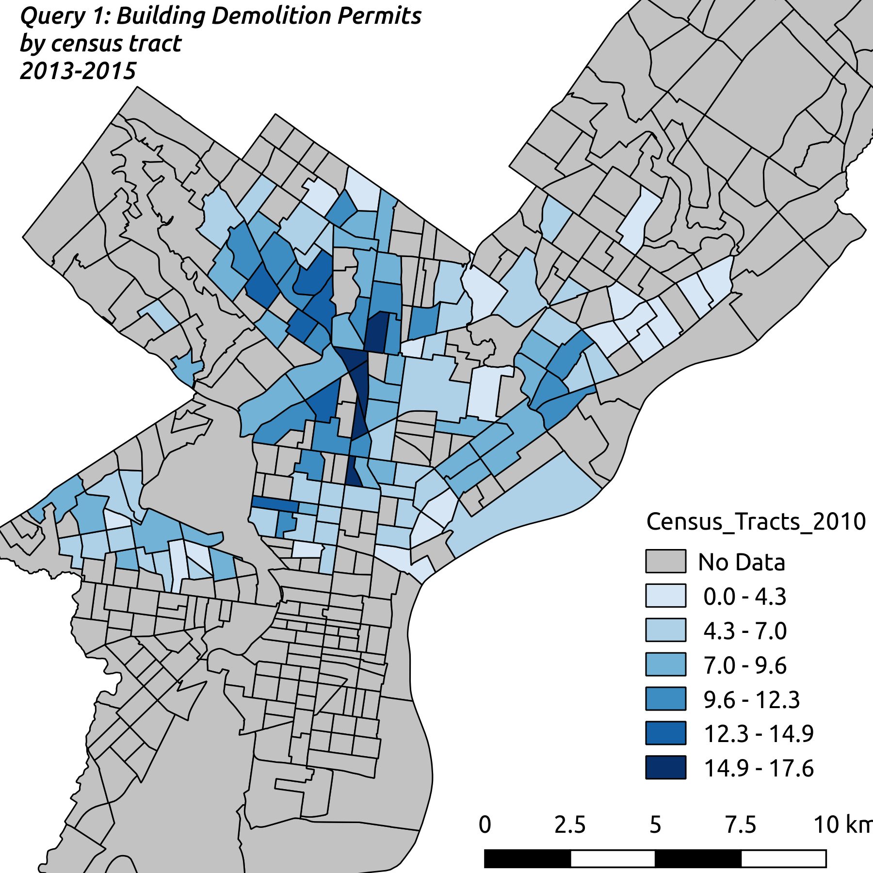
This ETL transformation was performed as an exercise in demonstrating proficiency using SQL in the PostgreSQL relational database with the PostGIS spatial extensions. I selected a spatial dataset of building demolition permits to load into the database and normalize to Third Normal Form. Once in place, this data can be combined with a secondary dataset on children with elevated blood lead levels to investigate correlations between demolition activity and elevated lead levels.
This analysis will use-high resolution satellite imagery to measure the effect that these forces have had on the amount of vegetative landcover and the amount of roofs with a reflective silver coating.
NoSQL databases are unlike many traditional SQL databases. In this tutorial we will review the differences between NoSQL and relational databases such as PostgreSQL, the strengths and weaknesses of a NoSQL database, and the reasons you might choose to use or avoid a NoSQL database. We will also demonstrate executing both spatial and non-spatial queries in MongoDB
This is a collection of maps I’ve created, mostly for a Cartographic Design class at Temple University, as part of their Professional Science Masters in GIS. Software used in this class included Adobe Illustrator, Mapbox, OpenStreetMap, and QGIS.